Besplatna dostava putem Box Now paketomata i Overseas kurirske službe iznad 59,99 €!

Besplatna dostava Overseas kurirskom službom iznad 59.99 €
Overseas 4.99 €
Pošta 4.99 €
DPD 5.99 €
GLS 3.99 €
GLS paketomat 3.49 €
Box Now 4.49 €
 Kako kupovati
Pomoć
Dostava
Overseas 4.99 €
Pošta 4.99 €
DPD 5.99 €
GLS 3.99 €
GLS paketomat 3.49 €
Box Now 4.49 €
Besplatna dostava Overseas kurirskom službom iznad 59.99 €
Savjetnik za kupnju
Ovdje smo zbog vas!
+385 21 784 0072
Moj račun
Pridružite se zajednici ljubitelja knjige iz cijelog svijeta i ostvarite mnoštvo pogodnosti.
Izradite besplatni račun
▸
Prazno :-(
0
Besplatna dostava putem Box Now paketomata i Overseas kurirske službe iznad 59,99 €!
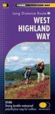
West Highland Way (Footprint Map)
Jezik
 Engleski
Engleski
Tiskanica
Mapa
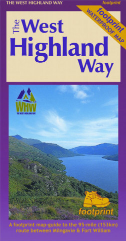
The West Highland Way waterproof map from Footprint is a map-guide to the 95 mile (153km) route betw...
Cijeli opis
Libristo kod: 16114719
?
 39 b
39 b
 TOP
TOP
39 b
TOP
15.66
€
Vanjske zalihe
Šaljemo za 3-5 dana
30 dana za povrat kupljenih proizvoda
Kupci su kupili i


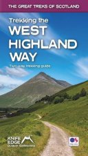
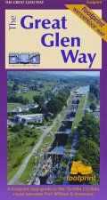
The West Highland Way waterproof map from Footprint is a map-guide to the 95 mile (153km) route between Milngavie and Fort William. The mapping is based on Ordnance Survey data at a scale of 1:40,000, with compact and concise information for walkers.
Informacije o knjizi
Puni naziv
West Highland Way (Footprint Map)
Jezik
Engleski
Engleski
Uvez
Tiskanica - Mapa
Datum izdanja
2017
EAN
9781871149937
ISBN
9781871149937
Libristo kod
16114719
Nakladnici
Footprint Maps
Težina
56
Dimenzije
140 x 230 x 3